I took these pictures today as I traveled my route to and from work (I'm a
merchandiser and travel to several towns in the area to service my store
displays.)
First, I went to the farm where I buy my milk and eggs. This is one of their ponies.
This is the sign at the entrance to their driveway.
After I took the milk and eggs home, I stopped at the little manmade wildlife pond down the road from us. I sometimes take my little dog Nikky for walks around it (the path around the pond is separated by a high chain-link fence.) There are a lot of waterfowl who use it as a resting area on their travels. Various ducks, loons, songbirds, Canada geese and the occasional heron. There are 2 small islands in the middle of the pond.
This is one of the paths that is fenced off and only county vehicles can access it.
Then, it was time to go to the next town over, Davis, to get some things at the Co-op. I pass this Freisian horse ranch several times a week. The area I live in still has a lot of open fields and agriculture. Lots of small farms and some bigger ranches.
I zoomed in with my camera on the previous scene and you can see three of the Freisians. They are beautiful.
My favorite store! The
Davis Food Co-op! The Big Tomato is their landmark. Davis has a reputation as pro-bike. Many bicycles on the roads and always places to park them!
This is at the entrance to the Co-op parking lot. This sign is a salute to the very first food co-op in England.
This clock is also at the entrance to the co-op parking lot and was erected in 1994 to celebrate 100 years of cooperatives in Davis (not just food co-ops, but others as well.
This mosaic carrot was added to the parking lot last year. It's kind of cool. The logo for the co-op was a carrot in a fist before it was the big tomato!
After I left the co-op, I headed toward Sacramento. I stopped at the
Yolo Bypass Wildlife Area. I've been in this area most of my life. This area was all rice paddies when I was growing up. But, in the '90s I moved to Florida. When I moved back here in 2000, this was here. But, even though I pass over it (the Bypass is Highway 80) several times a week, I had never been in it! I took the plunge today!
I only traveled a very small part of the Area. But, I found that it is free access during daylight hours, so I will definitely be back in the future!
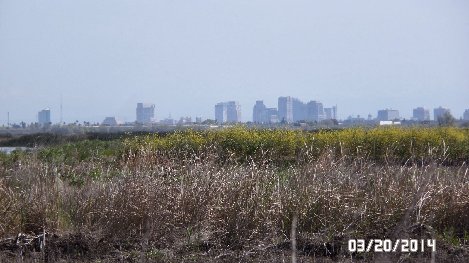
In the distance is part of the skyline of Sacramento as seen from the wildlife area.
This is Tule grass and is very common along the rivers and other waterways in this part of the Sacramento Valley.
Some waterfowl I scared when I was leaving the wildlife area. They had been on the roadway.
After work, I traveled up I-5 from Sacramento back home to Woodland. I pass the Sacramento International Airport. It is still surrounded by farmland, surprisingly.
After I crossed over the Sacramento River, I turned off onto the Old River Road. Before freeways, this was the main road between Sacramento and Woodland. I prefer using it rather than I-5. A lot less traffic. This is one of the railroad trestles that cross Tule Canal.
That is the Coastal Range in the distance beyond Woodland, taken from the Old River Road.
This is an off-shoot of the Tule Canal. Normally, there are a lot of fisherman fishing from the side of the road. But, I am not sure what the heck that brown stuff on the surface of the water is!!! Some kind of algae bloom, I suppose. That is my car parked on the other side of the road in the distance.
I hope you enjoyed my tour today!


No comments:
Post a Comment